
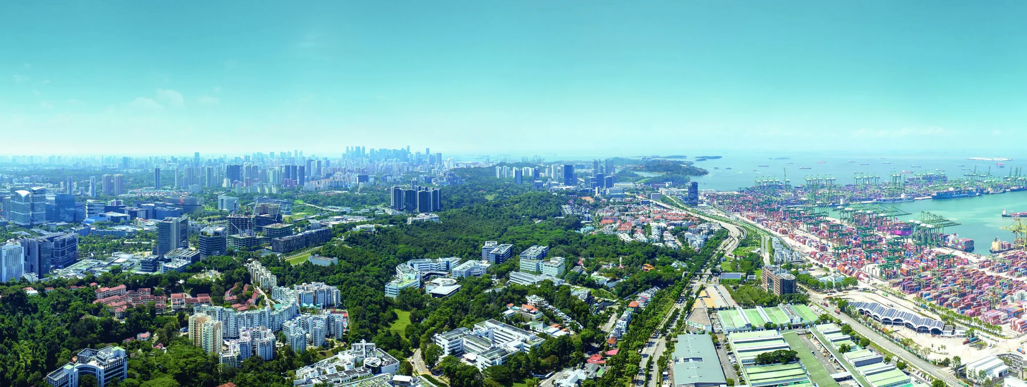
 For illustration only
The Hillshore and the Greater Southern Waterfront in Brief
The Hillshore stands across Pasir Panjang Road from the western end of the Greater Southern Waterfront, a corridor of about 30 kilometres along Singapore’s southern coast from Pasir Panjang to Marina East. As the city port terminals consolidate at Tuas, large areas of waterfront are planned for homes, parks, leisure and work.
The plans unfold over decades, so for a buyer today they are part of the long-term picture rather than a change that will arrive soon after completion in 2027.
The Scale of the Plans Around The Hillshore
The corridor covers about 2,000 hectares, which published reports describe as six times the size of Marina Bay. The developer’s brochure notes that 13 southern parks are to be rejuvenated and linked by curated trails, from the Gardens by the Bay East area to Pasir Panjang.
Much of the land becomes available only as port operations move, so the corridor will change in phases, with some areas, such as the former Keppel Club site, moving first.
The Port Move and The Hillshore
The working port below the hillside is part of the view from many homes at The Hillshore. The Pasir Panjang Terminal is among the port areas planned to move to Tuas, by 2040 according to the developer’s brochure, which describes the freed land as part of a new waterfront city for tourism, commercial and residential uses.
Until then the port remains, and for residents the cranes and ships are part of the character of the place, with the sea and the Southern Islands beyond.
Parks and the Promenade Near The Hillshore
The plans for the coast put parks first. The brochure describes a new 2.2-kilometre section of Pasir Panjang Park as part of a 17-kilometre route from Labrador Nature Park to West Coast Park, with more space for walking and cycling, and a Labrador nature park network adding more than 200 hectares of green space.
The Pasir Panjang Power District, east along the shore, is planned as a lifestyle area, with the power station moved underground to free space above, as the brochure describes.
New Neighbourhoods Along the Coast from The Hillshore
Further east, the former Keppel Club and Keppel Terminal land is being developed into the Berlayar estate, whose first public housing project launched in October 2025. Sentosa and Pulau Brani are planned for leisure and tourism, with new attractions, beaches and trails.
Together with the completed Circle Line loop, which since July 2026 puts Marina Bay on the same line as Haw Par Villa, these plans place Pasir Panjang within a coastline that is being steadily opened up to residents.
Weighing the Plans at The Hillshore
Plans of this kind can change, and their effect on any particular home cannot be promised. A buyer can, however, weigh what is already in place: a freehold title, a raised site with views to the sea, the Circle Line about five minutes away on foot, and the hill parks and research campuses close by.
The waterfront is a reason to look at the area over the long term, alongside the home, the location and the price list, rather than a reason on its own.
Getting to the Waterfront from The Hillshore
The coast is close at hand. On OneMap, Pasir Panjang Food Centre is about 1.7 kilometres from the site in a straight line, HortPark about 2.1 kilometres and Labrador Nature Reserve about 3.3 kilometres, and the developer’s brochure puts the West Coast Highway about two minutes away by car.
The Circle Line reaches the eastern end of the waterfront too. The stage that opened on 12 July 2026 added Keppel, Cantonment and Prince Edward Road stations, so a resident can travel from Haw Par Villa towards the new neighbourhoods along the coast without changing lines.
For now, the parks of the Southern Ridges are the easiest way to reach the shore on foot: from Kent Ridge Park the trails continue to HortPark and on towards Labrador, and the existing park connectors along Pasir Panjang link the hill parks with West Coast Park.
Exploring the Waterfront from The Hillshore
The waterfront guide and the location page go further, and the Circle Line guide covers the journey times. The Sales Concierge sends the current price list on request.
Showflat viewings are arranged by appointment through the Sales Concierge.
This article is general information as at the date shown and is not financial, legal or tax advice. Statutory figures are from IRAS and MAS; particulars of The Hillshore are from the developer’s brochure, unit plans and distribution chart, and dates from the developer and published reports.
Talk to The Hillshore Sales Concierge
The Sales Concierge sends the price list on request, the balance units and the e-brochure for The Hillshore. Showflat viewings are arranged by appointment through the Sales Concierge.